How high is the sky? It depends on where you live

Updated Sept. 9 at 8:15 a.m.Originally published Sept. 9, 2023
On a road trip from Phoenix to Washington D.C., you may notice the sky is falling – or at least the clouds are.
We often admire the shapes and sizes of those overhead puffs, but the height of those clouds can be equally dynamic, changing with the region and time of the year. Moisture, temperature and topography all play a part in how close we are to having our head in the clouds, literally.
“Over land, it’s really just a matter of how moist the air is more than anything,” said Roger Davies, a climate physicist at the University of Auckland in New Zealand.
At low altitudes, fluffy cotton-like cumulous and dark grey nimbostratus clouds garnish the sky, changing daily. Higher in the atmosphere, clouds become thinner and wispier, like cirrus clouds.
But beyond how they look from our perspective on the ground, their height has a greater influence on our day: it can determine the amount of sunlight and heat we experience. The thicker, low-level clouds help block solar radiation from hitting the surface, while the thinner, higher clouds trap the sun’s energy on Earth like a greenhouse gas.
Scientists, in an effort to better understand how energy circulates on Earth, simulate cloud properties in computer models. As Earth warms, scientists are concerned about whether climate change is affecting the height of the clouds. If so, that could affect the amount of sunlight and heat we experience at the surface.
“Clouds are the major regulator of the energy flow,” said Rachel Pinker, a meteorologist at the University of Maryland. “An important element is the cloud base height because this is what the Earth is seeing.”
Pinker and her colleagues analyzed 15 years of cloud data from weather stations across the United States. Specifically, they looked at lower-level, sun-blocking clouds (below 3,500 meters). Stations took daily readings of cloud height from the surface by shooting a laser upwards and measuring the time it takes to bounce back.
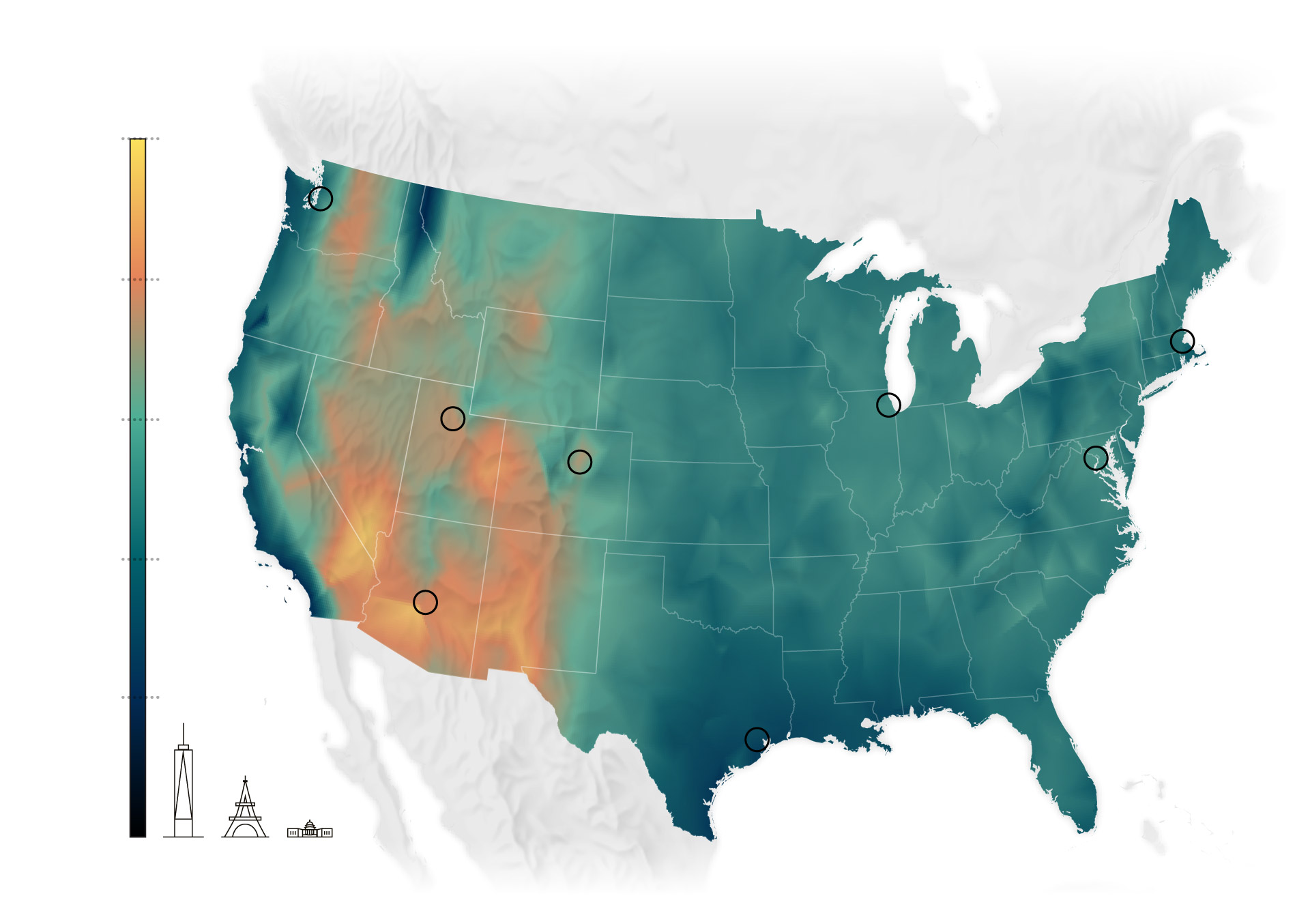
Overall, they found relatively higher clouds form in the western half of the country and during the summer, while lower clouds form on the East Coast and during winter. Clouds occurred more frequently over the East Coast and Pacific Northwest than in the Southwest and Central Plains.
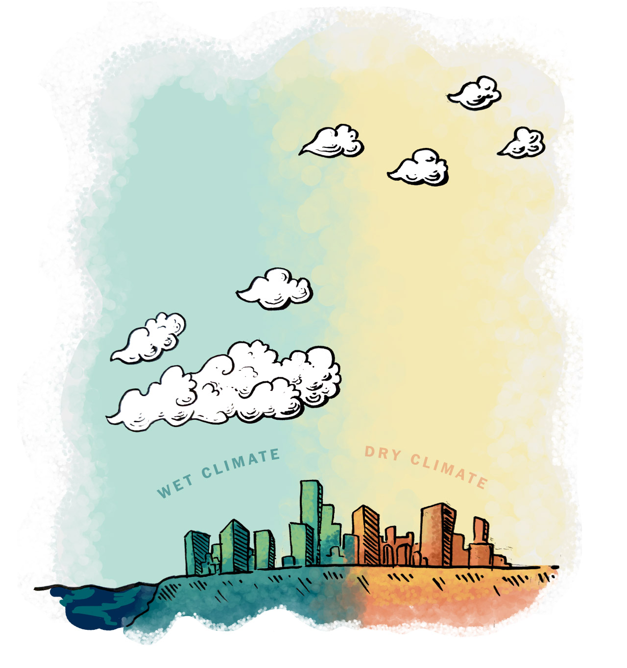
On the humid East Coast, clouds hang lower to the ground. In drier western parts of the U.S., clouds hang higher in the air, making downpours visible from miles away.
Warmer temperatures in the summer elevate clouds across the United States.
As temperatures cool, the air can hold less moisture and contains less clouds.
Cloud heights decreased the most during winter.
Cloud formation is based on simple physics. In general, clouds consist of liquid or solid ice water. They form when water from the ground or elsewhere evaporates into the air as invisible vapor. As this moisture moves to a colder temperature, the parcel of air becomes “saturated” with water (has 100 percent relative humidity). At that point, the water vapor condenses into liquid form on tiny aerosol particles called cloud condensation nuclei.
“The East coast is humid, so you have more moisture, and it reaches saturation at a lower level,” said Pinker. “While in the west coast, you have less moisture, so you have to cool it much more. That means you have to move up higher to get the condensation.”
Accordingly, Pinker and her colleagues found that clouds occurred more frequently over the East Coast and Pacific Northwest than in the arid southwestern U.S., where low humidity keeps clouds at bay. The East Coast, especially around the Mid-Atlantic and Great Lakes regions, saw the most clouds during winter. In the Pacific Northwest, clouds formed the most often during the spring.
While the East Coast generally has lower clouds, some of the lowest clouds in the country form along the California coast. These coastal clouds also look different from the puffballs on the East Coast, heavily featuring stratus, stratocumulus clouds and fog. These clouds are linked with cooler atmospheric conditions at lower latitudes, said climate scientist Rachel Clemesha.
Typically, temperature decreases higher in the atmosphere due to a change in pressure, Clemesha said. However, in some places, such as along the California coast, warmer air sits above cooler air – known as a temperature inversion. Part of that is because cooler air comes from the North Pacific Ocean, fueling that stark temperature contrast.
“These clouds are more like a blanket because they hit that temperature inversion, and the air can’t keep moving up. They’re trapped there like a lid,” said Clemesha, a researcher at Scripps Institution of Oceanography. “They don’t have a puffy top usually.”
Researchers are unsure how a warming atmosphere will affect cloud heights — or how clouds will affect the climate. On one hand, a warmer atmosphere can “hold” more moisture, so there could be more low-level clouds. Those could reflect more energy back into space, providing a cooling effect, said Pinker. On the other hand, higher temperatures could move clouds higher, where they could trap heat on Earth.
“Which one is more dominant and what is the final impact of the heating?” said Pinker. “This is the puzzle.”
But researchers are working to find an answer. One study showed that clouds heights – measured from the top from a NASA satellite – decreased across the world, simply because fewer clouds formed at higher latitudes. Davies, the lead author, however said that more long-term data is needed to see if this is a trend caused by climate change.
If not climate change, Clemesha and her colleagues have shown clouds heights are shifting due to other changing conditions – like urbanization. In cities, building materials (like concrete and asphalt) absorb more heat and raise the temperature of the city, especially at night. The team found that cloud heights in Los Angeles and San Diego actually increased with the temperature and became less frequent overnight.
If cloud height changes, that could impact fire conditions in certain parts of the country like California. For instance, lower-level clouds could bring more moisture to water-starved vegetation and lower fire risk, said Clemesha.
“We know the basic physics of why [clouds] are where they are and some of their properties,” said Davies. “What we don’t know about clouds is really how they provide a feedback to the climate system.”


No comments:
Post a Comment